Days 51-54
Dates: 31st July – 3rd August
Distance – 361km
Total distance: 3257km
Apologies for not having published a blog for 9 days – this expedition has been full on and exhausting, with a lot of highlights and tough times. Before I launch into writing about my journey across the Anne Beadell Highway, I think it is important to give some background of how it came to being and why it is there.
Len Beadell was an army surveyor and an explorer who, after the Second World War, was employed by the Australian-British government alliance, initially to select and map out the area and military township of Woomera (1947), choose the line of fire for a rocket range from the launch pads he also positioned, northwest across the country to Eighty Mile Beach on the Pilbara Coast (between Port Hedland and Broome). The rockets needed to be tested over land rather than water so scientists could accurately measure their experiments.
In 1952, he was asked to find a site to make the first atomic tests for the British government on the Australian mainland, He again selected and surveyed the site as well an airfield. He then built an access track (1953) from Mabel Downs Station near Coober Pedy across the desert to the site he called Emu (due to the emu footprints on the clay pan that was to become the airfield.) This was a top secret mission and all of the heavy equipment and building materials were transported across the desert, along the track.
Len, along with his Gunbarrel Road Construction Party went on to build more than 6000km of tracks, particularly in the then inaccessible regions in Western Australia, South Australia and the Northern Territory. The tracks, primarily built by pushing a bulldozer and a grader through the desert, were initially constructed to enable the scientists to access these roadless areas within the rocket range. The long term legacy is that these regions were opened up for people to explore the country for the first time and they facilitated connections with Aboriginal cultures living across Australia’s vast interior.
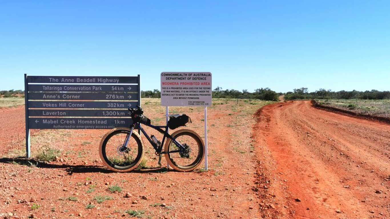
In the late 1950s and early 1960s, Len extended the track he built to access the atomic test site at Emu to connect Coober Pedy to Laverton in Western Australia and named the 1350km track after his wife, Anne Beadell. While it is called a highway, it is nothing of the sort. Rather, it is one of the roughest long distance tracks in the country with a fearsome reputation for destroying vehicles on its continuous deep corrugations. As I set off from Coober Pedy, delighted to be back on the road, I also wondered how the conditions would affect my bicycle, and me!
DAY 51 | COOBER PEDY TO TALLARINGA CONSERVATION PARK | 70 KM
Out of Coober Pedy I pedalled north for about three kilometres on the Stuart Highway before turning on to the Mabel Creek Road, a reasonable quality gravel road. It was a relief to be finally on the road and heading west. After about 15km, the opal mining mullocks petered out and I was pushing across grassy slowly undulating country with the aid of a light tailwind.
To my surprise, I encountered six pristine-looking tourist buses travelling towards Coober Pedy. I was heading into the remote Great Victoria Desert and I could not work out where the busloads of people were coming from. It all made sense when, after 39km, I spotted the new Ghan train stationary on the Trans-Continental Railway Line, about a kilometre away from the road. The buses were loaded with Ghan travellers who were off to Coober Pedy on a day trip. I cycled up to the train and struck a great conversation with one of the train drivers, Terry Smith. The staff had a seven-hour wait until the clients returned. I felt tiny up against the train.
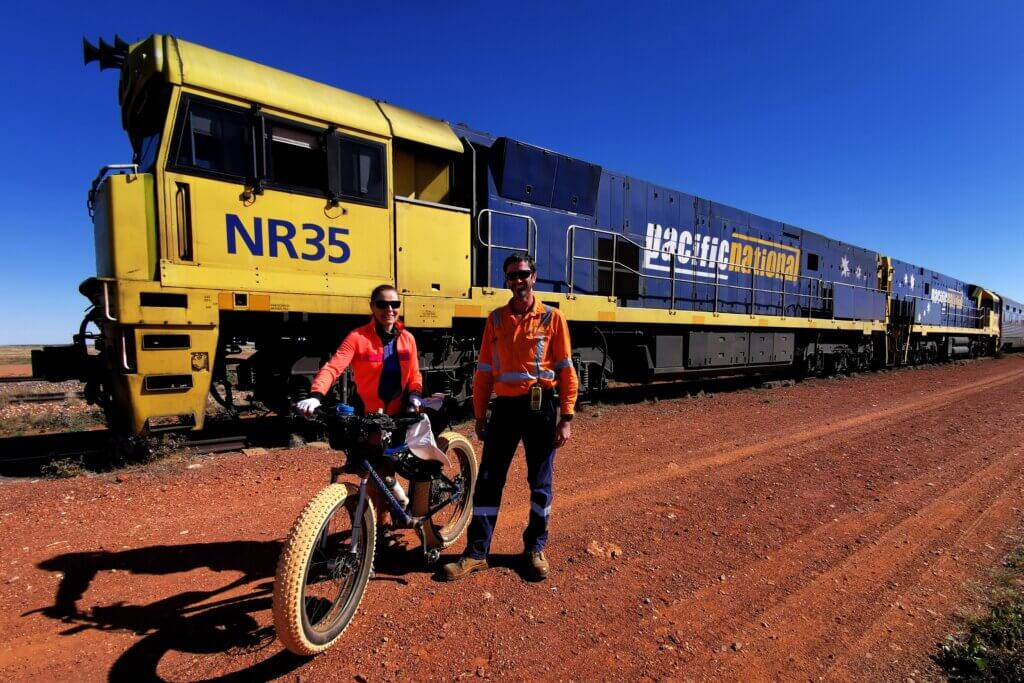
The 26 carriages gleamed in the sunshine as I crossed the tracks and set off towards Mabel Creek Station and the start of the Anne Beadell Highway about 7km from the rail crossing.
Setting off along the Anne Beadell, it felt pretty tame compared to its rugged reputation because the owner of Mabel Creek Station had graded the road that crossed his land. The bush was verdant, blooming with sprays of yellow and white flowers – hardly a parched, dusty outback track?

About 15km from the Tallaringa Conservation Park fence line, the graded road ended and the surface was appalling! My speed dropped dramatically as there was not even a narrow strip of track that was void of corrugations. At last light I caught the team who had set up camp beside the eastern gate into the Tallaringa Conservation Park. It was great to be enjoying another bush camp beside a crackling campfire.
DAYS 52 + 53 | TALLARINGY CONSERVATION PARK – EMU | 100 KM + 82 KM
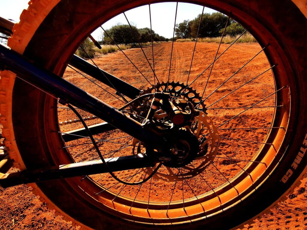
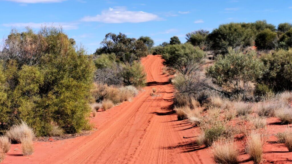
After entering through the eastern gate of Tallaringa, I set off along the fence line of the conservation park. I had been pretty worried about the state of the road the previous evening – it was rough but I started to read the tracks and make better decisions. My fatbike was worth its weight in gold on the sandy, corrugated road and I was often able to “float” over the sandy centre strip of the road to avoid many corrugated sections.

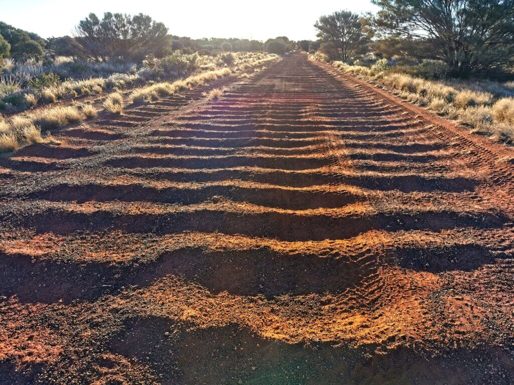
I could not have done this with a standard MTB – the wider tyres really made a difference in these challenging track conditions. The daily average speed was still 14.3km per hour, faster than I expected on these surfaces and I was able to exceed expectations by cycling another 100km day, pushing 12km west of Tallaringa Conservation Park and into Maralinga Lands.
I started to cross a series of steep sand dunes where the maximum gradient was around 14%. The corrugations were terrible but every so often there were short diversion tracks that gave at least some relief. Our gear in the trailer was the real casualty – unopened milk cartons wore through and leaked, tins compounded into each other, destroying the contents, bags wore through and don’t mention the eggs! Twice we had to clean and rearrange our food and gear, wasting valuable riding time.
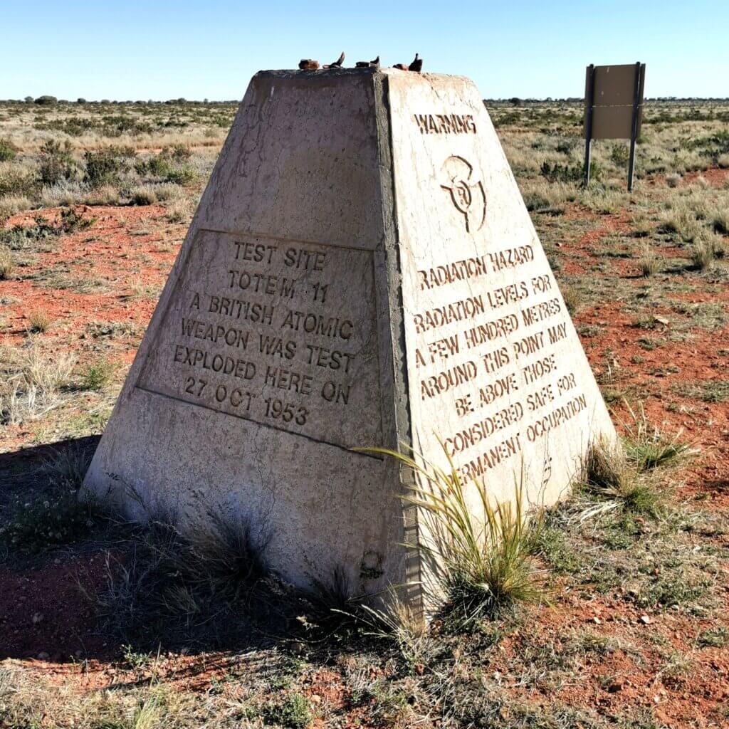
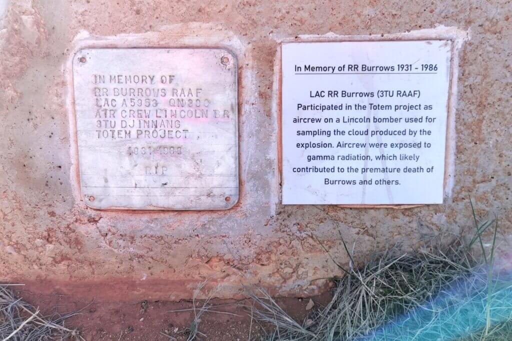
After 62km we came to the turn off to where the British, in 1953, detonated the first two atomic bombs on the Australian mainland – Totem I and Totem II. The site was selected by Len Beadell because it was a desolate expanse with little tree cover and they said, no one lived there. The explosions occurred from 100ft towers, vaporising / melting everything around – melting the metal towers, liquifying the sand and causing shockwave ripples in the ground. It was an interesting place to visit, but not necessarily a part of Australia’s history I am proud of.
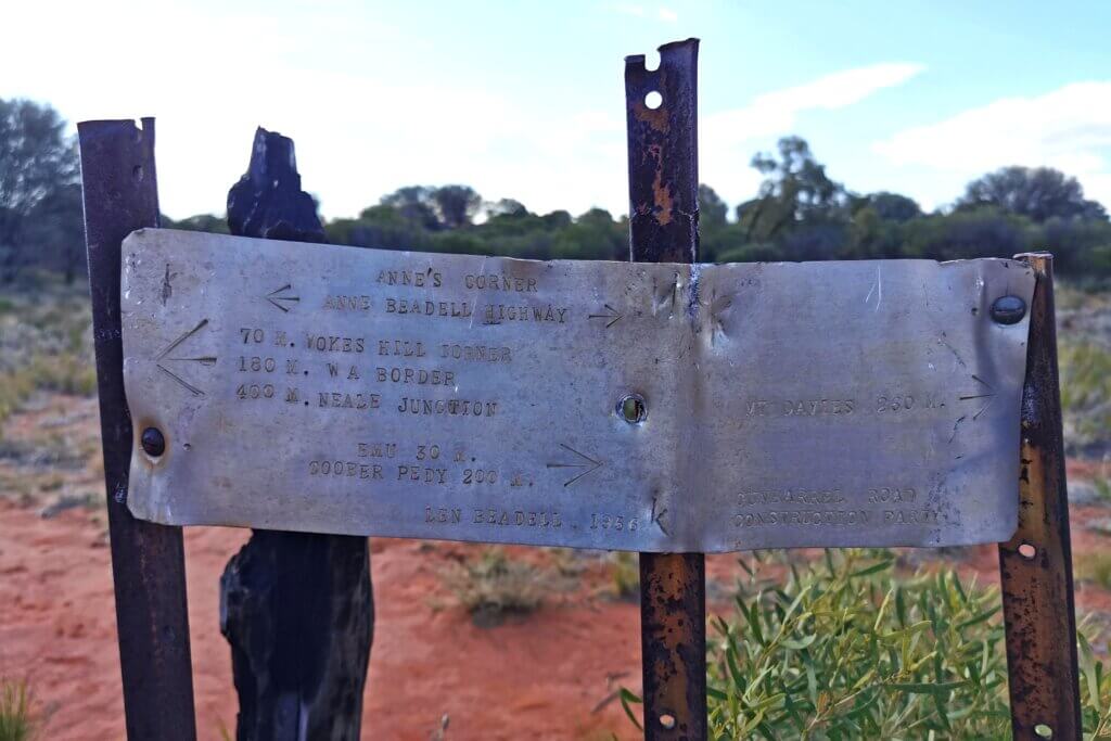
DAY 54 | TO ANNE’S CORNER + 15 KM | 71 KM
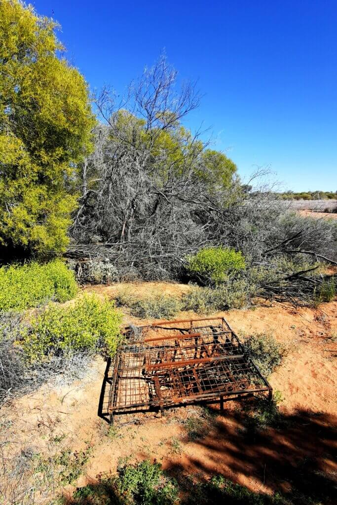
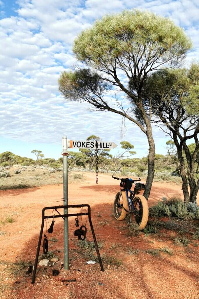
Two kilometres from where we camped, I reached Emu Fields. The airstrip and again, all sites were selected and surveyed by Len Beadell. There isn’t much to see at all now. There is some rusting metal but much was cleared away soon after the nuclear experiments occurred – the whole mission was top secret and the evidence was largely destroyed. The aerodrome on Emu clay pan was identifiable but the townsite where all the scientists (Australian and British) and officials would have lived had only some foundations left.
This ended up being a tough day at the office! It was much hotter and I struggled through the sand hill country. There was a strong, gusting headwind too, which made it harder to keep upright and on the sand!
I toiled through the heat of the day and, leaving my long sleeved cycling jacket on to protect my arms from the sun, cooked myself. I could not find any energy and whatever I did, I felt hot and exhausted. I was trying to reach my planned 90km a day average – the distance I needed to do to reach Tjuntjuntjara on time. Martin helped convince me to stop after only 71km so I didn’t push too far into the red. I rehydrated and sat quietly for a while.